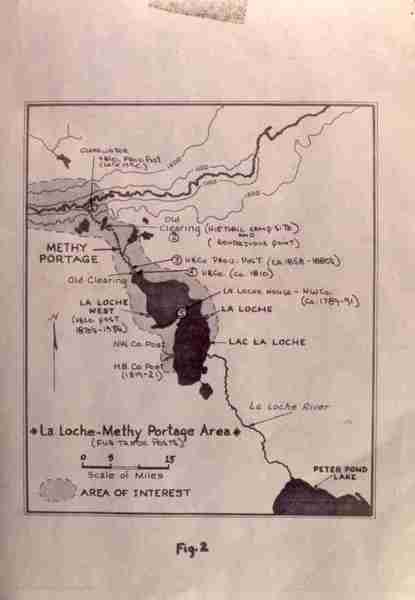
La Loche-Methy Portage Area Map
Institute for Northern Studies fonds, University of Saskatchewan Archives
Institute for Northern Studies (INS) fonds – F2100. Binder 10. II. Slides – 4501 to 5000.
La Loche-Methy Portage Area Map
Institute for Northern Studies fonds, University of Saskatchewan Archives
Institute for Northern Studies (INS) fonds – F2100. Binder 10. II. Slides – 4501 to 5000.